2016

An interesting feature of this scenario is that Dumayr Airport doesnt appear to be anywhere near a recognised ISIS held territory. If you look at maps of who holds what in Syria the area around both Dumayr Airport and Damascus is held by the government or the rebels. I think that the reports might be confusing Daesh with ISIS or just calling them both by the same name, not that I know the difference.
The reports also reffer to the use of VBIED's (vehicle borne improvised explosive device). I did consider making a VBIED unit but I really dont have time but it would be intersting to have such units along with the forthcoming irregular units and irregular rules to see how that works out.
The press TV article states that Dumayr was held by Jaysh al-Islam and Jaysh Tahrir al-Sham militants in December 2015 and was captured by the Syrian army, which might indicated that its actually these militants and not ISIS that are involved although thats just speculation.
The AA site shows a map from January 2016 indicating that the area was controlled by regime forces with Free Syrian army units nearby and further off Deash contested areas, but no ISIS so its not clear whats happening. Its says 'The city of Al-Dumayr, located some 40 kilometers northeast of Damascus, also remains under a regime-imposed blockade.' as well as reffering to two other nearby places 'Opposition-held Jayrud and Rabayah, both located in eastern Damascus, face frequent attacks by both the Assad regime and Daesh. Both towns have remained under a regime-imposed blockade since April 2013.'
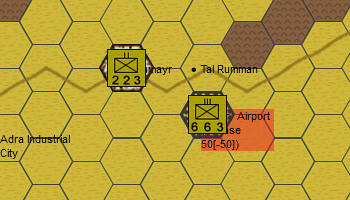
Either way, I have put some mobile ISIS units in the bottom right and a Syrian unit fortified in the objective Dumayr Airport.
Damascus is about 40km to the south West.
see Southfront
see New York Times
see ABNA24
see Press TV
see AA